 | |
| Type: | Tornado outbreak |
| Active: | March 8, 2022 |
| Duration of tornado outbreak1: | Unknown |
| Maximum rated tornado2: | EF5 tornado |
| Highest winds | 280 mph (455 km/h) (Thompsonville, IL EF5 tornado) |
| Tornadoes confirmed: | 106 confirmed |
| Damage: | $755 million (2022 USD) |
| Injuries: | 102 injured |
| Fatalities: | 49 dead |
| Areas affected: | Illinois, Indiana, Kentucky, Tennessee, Iowa and Missouri |
|
1Time from first tornado to last tornado | |
On March 8, 2022, a outbreak of severe thunderstorms and tornadoes, a few of which were strong and long-tracked, impacted portions of the Midwestern United States. Among these tornadoes included a EF5 tornado that decimated large parts of the town of Thompsonville, Illinois, causing a death toll in the dozens, and nearly $100 million in damages.
Meteorological synopsis[]
Preceding days -[]
As early as February 26, models had begun pointing towards the possibility of a severe weather outbreak in late March across the eastern half of the United States. By March 1, models had came into range and the SPC denoted the possibility of severe thunderstorms in the southern Great Plains on March 7, followed by a extended risk of a possible tornado outbreak across the Tennessee River Valley on March 8. As model agreement began to shift the threat north, on March 3 the SPC felt confident enough to highlight a 15% chance of severe weather for March 8 for portions of Tennessee, Kentucky and Illinois. This was upgraded to a 30% chance of severe weather early on March 4, with tornadoes as the primary concern.
A day 3 enhanced risk was highlighted for portions of Indiana and Kentucky on March 6, later being shifted west and upgraded to a moderate risk early on March 7. A 15% + hatched risk of tornadoes was the primary concern for portions of central Illinois and west central Indiana, with a 10% + hatched risk extending into western Kentucky. Also on March 7, the SPC had highlighted a day 1 enhanced risk of severe thunderstorms along a corridor from Austin, Texas to Oklahoma City, Oklahoma, with a 10% + hatched risk of tornadoes being the main concern. However, this event would fail to consolidate due to a cap, with a few weak EF0 tornadoes occurring on March 7 across north Texas.
Main event -[]
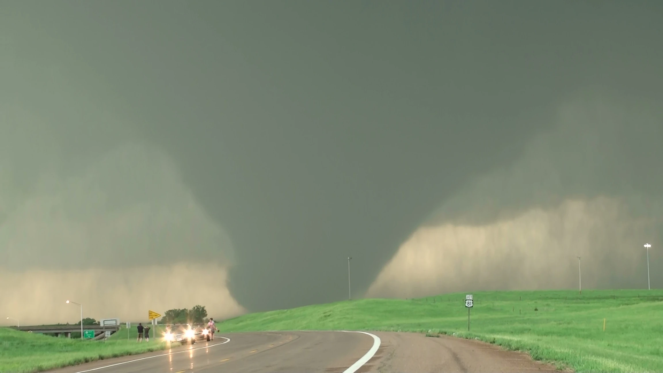
On the morning of March 8, the moderate risk was maintained, although shifted southeast into southeastern Illinois, southwestern Indiana and western Kentucky. It was driven by a 15% + hatched tornado threat, as well as a 45% + hatched wind threat. A massive, powerful low pressure system was expected to set itself up over Minnesota that morning, and was expected to shift a dry line into conditions favorable for initiation of strong, long-lived supercells across portions of Missouri and Illinois, with the threat for a few supercells extending up into Iowa. These cells would likely remain discrete for hours, tracking across a area with wind shear of 45-50 kts, CAPE values of 5,500 J/kg and significant tornado parameter values of 8 to 11. At 14Z, NWS Paducah did a special weather balloon launch, which revealed the presence of a moderate-strength cap in the atmosphere, however a otherwise very-favorable atmosphere across portions of northwest Kentucky and southern Illinois.
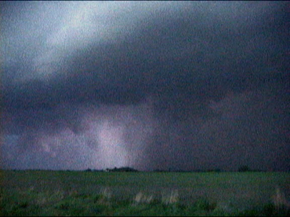
The 20Z outlook on March 8.
The cap would've likely been strong enough to prevent storms from firing if it did not break by 19Z, while had it broken by that time, a significant tornado outbreak would've likely occurred. Additional weather balloon launches at 15Z revealed the cap had weakened somewhat, to the point that certainty of initiation had increased to the point to allow the SPC to upgrade parts of Illinois, Indiana and Kentucky to a high risk of severe thunderstorms in the 1630Z outlook, with a 30% + hatched threat of tornadoes being the main concern. Preparations began across the region for a major tornado outbreak, with schools being dismissed around 17Z across the high and moderate risk areas, and public storm shelters being opened around 18Z.
Not long before 19Z, the SPC issued a PDS tornado watch for large parts of Illinois, Indiana and Kentucky, with a 95% chance of 2 or more tornadoes, as well as a 80% chance of 1 or more strong tornadoes. Explosive development of supercells began along the dry line shortly after 19Z, with these supercells moving east at around 25 to 35 mph, through a moist and extremely unstable atmosphere. A 60% + hatched wind threat was introduced in the 20Z outlook for portions of southern Illinois and southwestern Indiana, with the outlook having the headline "Major tornado outbreak underway across portions of the Ohio River Valley. Several strong, long-tracked tornadoes likely, as well as widespread damaging winds to 100 mph". A line of discrete tornadic supercells tracked across southern Illinois and northwestern Kentucky, producing widespread significant wind damage. The tornadoes that did touch down were very intense and long-tracked, with a EF5 tornado wiping large parts of Thompsonville, Illinois off the map. By 03Z, the high risk had been expanded up into central Indiana, becoming mainly wind-driven, with the tornado threat being downgraded to 15% + hatched in the 01Z outlook, as the supercells congealed into a squall line, moving across large parts of Indiana and Kentucky that evening, before breaking up over Ohio and West Virginia.
Notable tornadoes[]
See article here: List of tornadoes in the 2022 Thompsonville, Illinois tornado outbreak
Benton-Thompsonville, Illinois[]
| EF5 tornado (NWS) | |||
|---|---|---|---|
| |||
| Duration | 2135 – 2204 | ||
| Intensity | 455 km/h (280 mph) (1-min) | ||
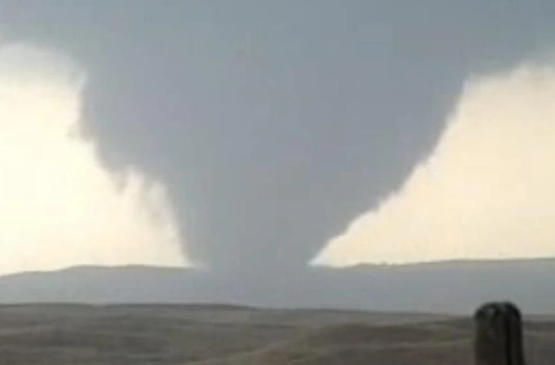
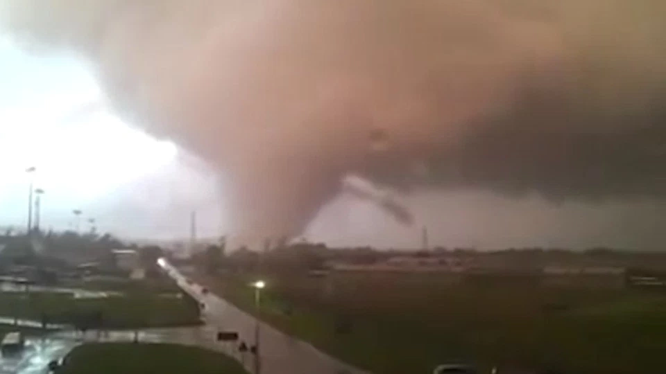
At 2135, a tornado touched down just east of Interstate 57 in Benton, Illinois. From here, the tornado gradually intensified, causing EF1-EF2 damage across downtown Benton, before intensifying into a EF3 over southeastern Benton, producing damage comparable to a tornado with winds of 160 mph at Benton School District. 2 people were killed in Benton, and the maximum damage here was rated 165 mph EF3. The tornado rapidly intensified as it moved adjacent to Illinois Route 34, the tornado then struck Logan, causing widespread EF3 to EF4 damage, with a row of houses sustaining minimum EF5 damage here. Every house in Parrish was destroyed as the now EF5 wedge tornado moved through the town. A tornado emergency was issued for the Thompsonville area at 2147 as the massive wedge tornado moved towards the town.
Widespread significant tornado damage occurred throughout almost the entirety of Thompsonville, with some of the most extreme tornado damage ever documented being noted at points in Thompsonville. Despite this, the tornado rapidly weakened and lifted about 10 miles southeast of Thompsonville. 36 people were killed in Thompsonville, in addition to the 2 in Benton and 2 in Logan, resulting in a total of 40 deaths.
Pryorsburg-Mayfield, Kentucky[]
| EF4 tornado (NWS) | |||
|---|---|---|---|
| |||
| Duration | 2155 – 2230 | ||
| Intensity | 280 km/h (175 mph) (1-min) | ||

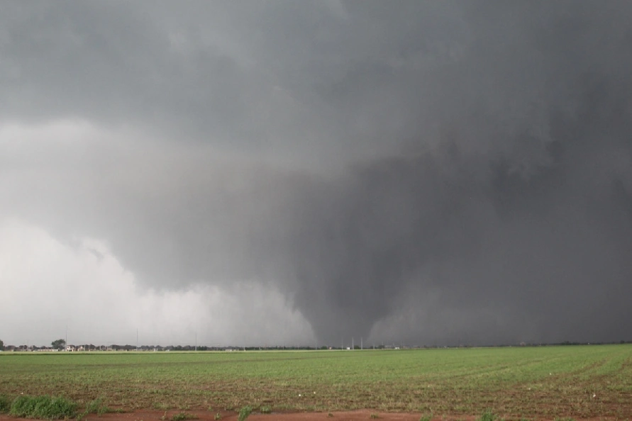
Often considered the most forgotten violent tornado of the outbreak, as well as the most forgotten of 2022, with some dubbing it the "Forgotten Tornado of 2022". The tornado touched down at 2155 about 3 miles west of the small town of Wingo, Kentucky. It quickly moved northeast across Interstate 69, quickly intensifying into a EF2 tornado in the process. At around 2203, the tornado began a abrupt turn north, explosively growing in both intensity and size, becoming a massive wedge tornado with a peak width of nearly 0.85 miles wide. It proceeded to directly strike the small community of Pryorsburg, wiping the town of 311 off the map, while remarkably killing no one.
It continued to parallel Interstate 69 as a large cone to occasionally large wedge tornado, entering Mayfield at around 2210 at a width of roughly 0.55 miles. It caused widespread significant damage in suburban Mayfield, with various houses and businesses being completely leveled. Several cars were thrown over a mile from their place of origin, with one car being thrown into a Walmart on the south side of Mayfield. A receipt from Mayfield landed near Cairo, Illinois, however it may have been also carried by another, weaker tornado that struck Paducah. The tornado peaked at a width of a mile wide as it exited Mayfield, throwing cars from Interstate 69 before rapidly weakening and lifting near Westplains at 2230. Despite the severe damage, in excess of $130 million caused by the tornado, no one was killed and only two people were injured.
Grove Center, Kentucky[]
| EF2 tornado (NWS) | |||
|---|---|---|---|
| |||
| Duration | 2236 – 2250 | ||
| Intensity | 205 km/h (125 mph) (1-min) | ||
Likely the second most violent tornado of the outbreak, the Grove Center tornado touched down just outside of the community of Henshaw, moving north and explosively intensifying as it moved over Kentucky Route 130. Radar shown that the tornado peaked with winds of nearly 240 mph at this time, suggesting EF5 intensity, and ground scouring also suggested low-end EF5 winds were occurring on the ground at this point. The tornado however never struck any buildings, and harmlessly meandered north of Grove Center as a EF2, besides a group of several poorly-built buildings which were completely leveled and swept away. It also destroyed a few grain silos. It rapidly weakened and lifted as it approached Morganfield at 2250.
Mount Vernon-Marlow-Bluford, Illinois[]
| EF4 tornado (NWS) | |||
|---|---|---|---|
| |||
| Duration | 2301 – 2336 | ||
| Intensity | 285 km/h (180 mph) (1-min) | ||
Among the most violent tornadoes of the outbreak, this tornado first touched down as a rope-shaped tornado just south of Mount Vernon, Illinois, quickly moving northeastward, causing EF1-EF2 damage to several buildings. By 2320, the tornado was entering Marlow, Illinois, and underwent rapid intensification into a EF4 tornado in the process. 2 people were killed in Marlow as the violent tornado moved through, and every building in the town was destroyed. From here, the now borderline wedge tornado moved straight towards the town of Bluford, jerking northward and rapidly weakening just before striking the town. The tornado lifted at 2336, north of Bluford.
West Paducah, Kentucky[]
| EF1 tornado (NWS) | |||
|---|---|---|---|
| |||
| Duration | 2315 – 2322 | ||
| Intensity | 175 km/h (110 mph) (1-min) | ||
Not a particularly intense tornado, the West Paducah tornado first touched down southwest of Barkley Regional Airport at 2315, and moved northeast, striking residential areas as a large yet weak EF1 tornado. From here, the tornado continued northeast, striking parts of Barkley Regional Airport's runway, before directly striking the National Weather Service in Paducah's office, causing damage indicative of 110 mph winds, and knocking the doppler radar offline for about 15 minutes. It continued northeast, nearing EF2 intensity over a field as it peaked in width at nearly half a mile wide. However, rapid weakening ensued as the tornado moved towards the Ohio River, and it lifted at 2322. This tornado was notable for being one of a few to directly strike a National Weather Service office.
Phillipstown, Illinois-Griffin-Crawleyville-Hazleton, Indiana[]
| EF4 tornado (NWS) | |||
|---|---|---|---|
| |||
| Duration | 2319 – 2350 | ||
| Intensity | 325 km/h (200 mph) (1-min) | ||
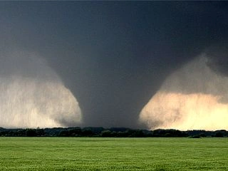
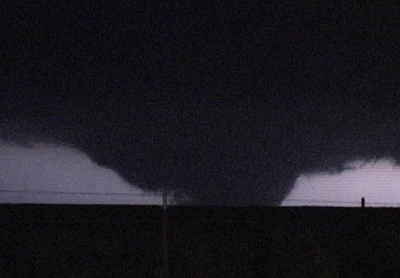
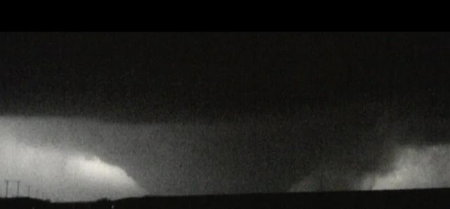
The first tornado of the day in Indiana, as well as among the widest tornadoes on record, this tornado first touched down as a rope-shaped tornado in a field northeast of Phillipstown, Illinois. As the tornado moved northeast and crossed the Wabash River into Indiana, it rapidly grew in size and intensity, being a large cone EF3 tornado by the time it had reached the community of Griffin.


The tornado as seen from Mount Carmel, just west of the Wabash River.
Every building in Griffin was destroyed, with some damage nearing EF4 intensity. However, as the tornado moved out of the town, it explosively grew in size, reaching over a mile and a half wide just 5 miles northeast of Griffin. It continued northeast over open fields, reaching 1.85 miles wide at one point in time, before striking the community of Crawleyville as a very high-end EF4. Some damage here was noted of possible EF5 intensity, mainly several anchor-bolted houses that were cleanly swept, a few of which had washers. One house had a anchor bolt warped, while another house had a anchor bolt partially pulled out of the ground. A concrete slab, previously holding a mobile home, was also partially pulled out of the ground.
The tornado continued north, peaking at a massive width of 1.93 miles wide over a field, although some surveyors found a possible width as large as 2.25 miles wide in spots. From here, the tornado began to shrink in size, but hold it's intensity, causing extreme damage and completely wiping the community of Skelton off the map. Every building in the town sustained EF4 damage, with some damage being noted as possible EF5 damage. After crossing Broad Pond, the rain-wrapped tornado began to become more visible, and the tornado was visible from Mount Carmel, in Illinois, at this point in time. The tornado moved west of Patoka, before rapid weakening ensued. The tornado lifted at 2350 just northwest of Hazleton, Indiana.
Stilesville-Plainfield-Six Points, Indiana[]
| EF3 tornado (NWS) | |||
|---|---|---|---|
| |||
| Duration | 0416 – 0443 | ||
| Intensity | 260 km/h (160 mph) (1-min) | ||
As thunderstorms continued to slowly move across Indiana, a tornado touched down just south of Stilesville, Indiana at 0416, and quickly intensified over rural areas, with houses reporting EF1 to EF2 damage not long after touchdown. At around 0427, the tornado began to move into populated areas southwest of Indianapolis as a large wedge tornado, striking Plainfield Correctional Facility and causing severe damage.
The tornado then struck The Shops at Perry Crossing, causing several walls to collapse at a AMC movie theater, killing a employee. The tornado then began to rapidly weaken as it moved through the community of Six Points, and narrowly missed Indianapolis International Airport, lifting at 0443.
Nashville, Indiana[]
THIS IS A WORK-IN PROGRESS!
Tipton-Hobbs, Indiana[]
| EF4 tornado (NWS) | |||
|---|---|---|---|
| |||
| Duration | 0547 – 0625 | ||
| Intensity | 325 km/h (200 mph) (1-min) | ||

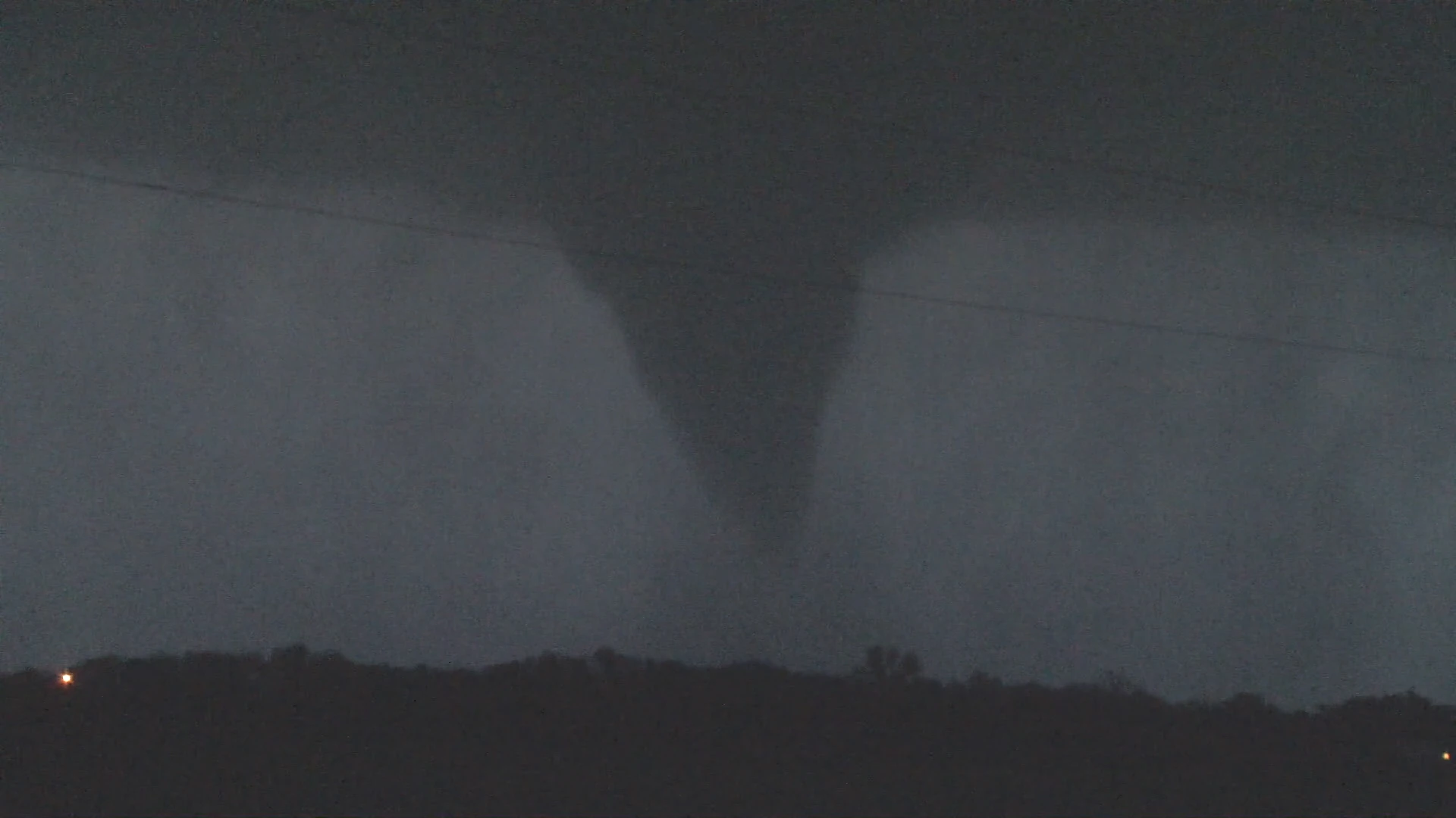
The second most violent, and second deadliest tornado of the outbreak, the Tipton tornado touched down as a semi-discrete supercell moved east across the state at 0547, about 5 miles southwest of Tipton. Said tornado moved northeast over open fields, quickly intensifying into a EF2 tornado before striking the first building along it's path.
Intensification continued as the tornado continued to move over largely rural areas, reaching EF4 intensity around 0555, and possibly nearing EF5 intensity around this point. However, some weakening ensued as the tornado moved further north and into the Tipton city limits, causing high-end EF4 damage to many buildings, narrowly missing the IU Health Tipton Hospital and the Tipton School District, although it did hit a part of Tipton High School.


Ground scouring in a field west of Tipton.
A tornado emergency was issued for the Tipton area at 0600 as a classic debris signature appeared on radar, alongside reports of powerflashes in the Tipton city limits. The tornado continued east, narrowly missing the center of Tipton, causing 4 deaths in the process, of which 3 were at the Country Living trailer park. The tornado shrunk in size but held it's intensity as it moved east, throwing dozens of cars from a Ford dealership, and destroying a Cargill facility. The tornado jerked southeastward some, completely wiping the small town of Hobbs off the face of the earth in the process. It began to significantly weaken as it moved north of Elwood, lifting at 0625. The funnel that produced this tornado briefly touched back down, producing EF2 damage north of Elwood not long later. This tornado was initially rated a 205 mph EF5 due to extreme ground scouring noted west of Tipton, later being downgraded to a 200 mph EF4 by the National Weather Service.
Summitville, Indiana[]
| EF3 tornado (NWS) | |||
|---|---|---|---|
| |||
| Duration | 0651 – 0714 | ||
| Intensity | 270 km/h (165 mph) (1-min) | ||
Yet another deadly tornado, this tornado touched down on the same supercell thunderstorm that had produced the Tipton tornado not long prior. Touching down about 5 miles west of Summitville, this tornado quickly grew in size and intensity as it moved over open fields, striking a cluster of houses at low-end EF3 intensity only about 3 to 4 minutes after touchdown. The last death of the outbreak occurred at one of these houses.
However, the tornado significantly shrunk in size and weakened some as it moved once again into open fields, reaching Summitville around 0705, causing widespread EF1-EF2 damage, with a few isolated pockets of EF3 damage. However, as it pulled north near Summitville Elementary School, it explosively intensified into a small yet intense high-end EF3 tornado, destroying many houses, although no injuries were reported. From here significant weakening occurred as the tornado crossed County Road 1700N at 0713, and lifted a minute later. The tornado was initially rated a 170 mph EF4 due to damage in the eastern part of Summitville, later being downgraded to 165 mph EF3 a few days later.
Abanaka-Ohio City, Ohio[]
| EF4 tornado (NWS) | |||
|---|---|---|---|
| |||
| Duration | 0804 – 0835 | ||
| Intensity | 270 km/h (170 mph) (1-min) | ||
The final violent tornado of the outbreak, as well as the first violent tornado in Ohio since the Dublin, Ohio EF5 tornado during the 2019 Super Outbreak, this tornado touched down on a circulation embedded in a squall line that was moving through northwestern Ohio early that morning. Said tornado quickly intensified into a large wedge EF3 tornado as it moved south of Abanaka, destroying 2 of the 7 buildings in the town.
It narrowly missed Dull, Ohio, before moving through Ohio City at a width about as wide as the village itself. Nearly every building in the village received moderate to severe damage, with a swath of EF4 damage being noted right through the middle of town. Several people were seriously injured, although no one was killed by this tornado. The tornado reached a massive width of 1.06 miles wide north of Ohio City, before considerable weakening ensued as it pulled east south of Van Wert. The tornado lifted at 0835, southeast of Van Wert.
Columbus, Ohio[]
THIS IS A WORK-IN PROGRESS!